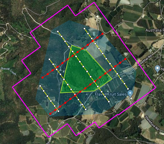
Are you interested in manned aerial mapping? Our flight planning software makes the planning phase of an aerial survey an easy and quick process.
We recently released a new video showcasing how to create a simple aerial mapping flight plan using a polygon to determine the area of interest of the aerial survey.
FlightPlanner, our lead running flight planning aerial mapping software helps you create beautiful aerial photography, alongside our award-winning aerial mapping and camera control software, Aviatrix.
Trying to create a flight plan can be a hassling time-consuming and expensive process. FlightPlanner takes care of all those nasty calculations, helping you create an aerial survey flight plan with sub-pixel accuracy. You can export your flight plan into multiple different file formats, including KML, KMZ, GPX, FPL and more formats.
The four steps of creating an aerial mapping plan on FlightPlanner:
- Build the Aerial Mapping Area of Interest
- Set Camera Parameters. Set which camera you are planning to use during the survey
- Imaging Parameters. These include altitude, ground speed, ground sample distance, forward and side overlap, swath width and much more
- Flight Line Orientation/Calculation Method
Click here to see a more in-depth article on these following steps.
If you are interested in purchasing or receiving a free demo for FlightPlanner, please contact us or request a demo.

